

APGS : Asio Payload Ground station
The APGS is the dedicated ASIO ground station. APGS controls the ASIO gimbal functions (direction, video tracking, geo tracking, detection and object tracking, EO/IR fusion) during the mission or for the post-mission replay.
Présentation
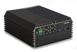
The APGS is composed of a rugged computer specially designed for field use and an optional joystick.

Video, métadata and map
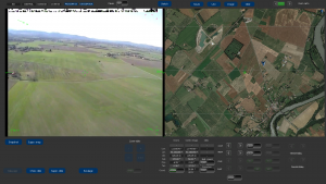
The APGS simultaneously displays the video and the map and show :
- Stanag 4609 from ASIO :
- UAV roll, pitch and heading
- UAV GPS position on the map
- Gimbal elevation and azimuth
- Camera zoom
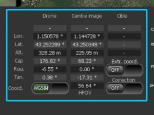
- From elevation informations :
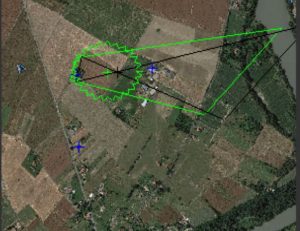
- The camera coverage area on the map
- The image center on the map
- The target position on the map
Mission functions
The APGS provides :
- Noteworthy points alignment ( align map points with video points) to enhance map positionning accuracy
- Image snapshot capture with metadata
- Stanag4609 format video recording
- Stanag4609 format video streaming
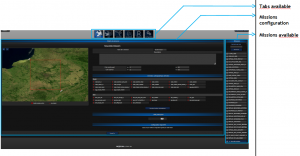
The APGS settings are easy to control via a simple web interface. :
Super-resolution
The super-resolution improves the video quality by reducing the noise and by locally accentuating contrast. The following video shows the significant contribution of the super-resolution:
EO_zoom_2deg8_sur_arbre
Zoom IR
Much more than a simple digital zoom, the APGS IR zoom provides a high-definition IR image.
Fusion EO/IR
The APGS provides various user-selectable and configurable fusion modes. The rendered image wisely superimposed the two sensor images and provide:
- A better target detection (a thermal shape of a person hide behind a bushy tree)
- Reconnaissance and identification (thermal signature)
- More informations (cold or warm engine) by keeping a clear global image thanks to the EO quality image
Automatic scanning area
The operator chooses how the UAV will automatically scan the area of interest.
Mission replay
Afetr the mission, the operator can replay the image, every real-time functions are avalaibles in replay mode.